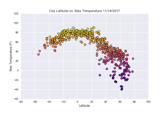
Summary: Latitude vs. Humidity
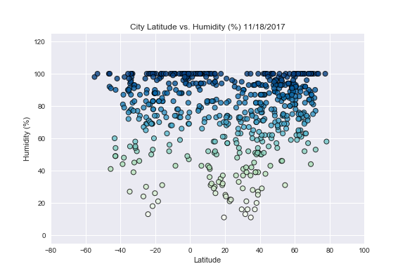
The analysis of the latitude versus the humidity occured on November 11, 2017. Humidity is the measure of water vapor in the air. When the humidity is 100% then the air can't hold any more water vapor. When surface temperature of the land masses and sea warms, it leads to more evaporation, and consequently an increase in humidity. An increase in humidity can lead to additional warming of the land masses and sea.
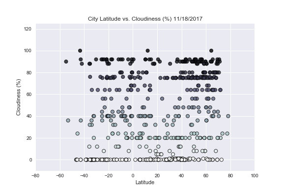
Analysis of the data shows that latitude does not impact the percent humidity. However, the majority of the cities generated from the analysis had humidity levels greater than 60%. Does this indicate more water evaporation due to increased global warming? Or, is it a result of generating random latitudes and longitudes? Since, the majority of the Earth (71%) is covered by water, where the majority of our randomly generated latitudes and longitudes over a body of water? If so, then this makes the nearest city to those latitudes and longitudes along coastlines and other bodies of water. Also, humidity is dependent upon temperature and cloudiness. Further analysis of the how many cities had maximum temperatures above 60° F may shed light on why the majority of cities had high levels of humidity. Click on the the Latitude vs. Cloudiness image to see how cloudy it is with a change in latitude.
Visualizations